High-altitude trekking routes are mountain trails that reach elevations where lower air pressure reduces the amount of oxygen available with each breath.
These routes often pass through dramatic landscapes, including snow-covered peaks, glacial valleys, alpine meadows, rocky ridges, and remote mountain villages. They attract hikers seeking physical challenges, natural scenery, and opportunities to experience high mountain environments.
Many well-known high-altitude trekking destinations are located in the Himalayas, Andes, Alps, and other major mountain ranges. Examples include the Everest Base Camp Trek in Nepal, the Markha Valley Trek in India's Ladakh region, the Annapurna Circuit in Nepal, and the Inca Trail in Peru. These routes differ in elevation, terrain, duration, weather, and logistical requirements.
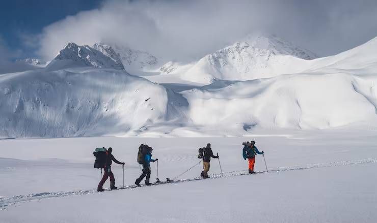
Trekking at high elevations requires more preparation than many lowland hikes. As altitude increases, the body needs time to adapt to reduced oxygen availability. This process, called acclimatization, is important for reducing the risk of altitude-related illness. Route planning, suitable equipment, gradual ascent, hydration, and awareness of weather conditions are essential parts of responsible trekking.
High-altitude trekking is not defined by a single universal elevation threshold. However, altitude-related health concerns become increasingly important above approximately 2,500 metres, particularly when people ascend rapidly or sleep at higher elevations.
Importance
Why High-Altitude Trekking Requires Preparation
High-altitude routes combine physical exertion with environmental conditions that may change rapidly. Trekkers can experience lower temperatures, strong winds, intense sunlight, reduced oxygen availability, and limited access to medical facilities.
Preparation helps trekkers manage these challenges and make informed decisions when conditions change. It also reduces the likelihood of avoidable problems such as inadequate clothing, dehydration, exhaustion, and poor route choices.
Important preparation priorities include:
- Physical conditioning: Cardiovascular fitness, leg strength, balance, and endurance help prepare the body for long days on uneven terrain.
- Gradual ascent: Allowing sufficient time for acclimatization reduces the risk of altitude-related illness.
- Weather awareness: Mountain weather can change quickly, affecting visibility, temperature, and trail safety.
- Appropriate equipment: Insulated clothing, sturdy footwear, navigation tools, and emergency supplies support safer travel.
- Route knowledge: Understanding distances, elevation changes, water availability, and escape options helps trekkers plan realistic daily stages.
- Emergency planning: Remote routes may have limited communication coverage and long evacuation times.
Physical fitness does not eliminate the risk of altitude sickness. Even experienced athletes can become ill if they ascend too quickly. A conservative itinerary and willingness to descend when necessary are therefore important.
Notable High-Altitude Trekking Routes
Several mountain routes are known for their scenery, cultural experiences, and elevation challenges.
1. Everest Base Camp Trek, Nepal
The Everest Base Camp Trek travels through Nepal's Khumbu region toward the base camp area of Mount Everest. The route typically begins near Lukla and passes through mountain settlements such as Namche Bazaar, Tengboche, Dingboche, and Gorak Shep.
The base camp area is approximately 5,364 metres above sea level, although itineraries and viewpoints vary. Trekkers encounter suspension bridges, glacial landscapes, Buddhist monasteries, and panoramic Himalayan views.
The trek commonly takes around 12–16 days, depending on the itinerary, acclimatization schedule, and starting and ending arrangements. High elevation makes gradual ascent essential, and travelers should be prepared for cold nights, basic facilities in some locations, and possible flight disruptions.
2. Annapurna Circuit, Nepal
The Annapurna Circuit passes through diverse landscapes in Nepal's Annapurna region, including subtropical valleys, traditional villages, forests, and high mountain terrain. Many itineraries cross Thorong La Pass, which is approximately 5,416 metres above sea level.
The route's length varies because road access and itinerary choices can shorten or alter the traditional circuit. Trekkers may encounter significant elevation changes, cold conditions, and demanding days near the pass.
A carefully planned itinerary should include acclimatization and contingency time. The high pass can be affected by snow, wind, and other weather conditions, so local guidance and current trail information are important.
3. Markha Valley Trek, Ladakh, India
The Markha Valley Trek is located in Ladakh, a high-altitude region of the Indian Himalayas. The route crosses arid mountain landscapes, river valleys, villages, and high passes, including Kongmaru La, which is commonly described as being around 5,200 metres above sea level.
The trek offers views of rugged peaks and opportunities to observe local architecture and regional traditions. However, the region's high starting elevation means visitors should allow time to acclimatize before undertaking strenuous activity.
Conditions can be dry, sunny, windy, and cold, sometimes within the same day. Trekkers should plan water supplies carefully, check local access restrictions, and use a reliable guide when route conditions or experience levels warrant it.
4. Inca Trail, Peru
The classic Inca Trail leads through the Andes toward Machu Picchu, passing archaeological sites, mountain scenery, and cloud forest. The highest point on the classic route is Dead Woman's Pass, approximately 4,215 metres above sea level.
Although it is lower than some Himalayan routes, the Inca Trail still involves significant elevation changes and long days of walking. Stone steps, uneven surfaces, and variable weather can make the journey physically demanding.
Access to the classic trail is regulated, and permits are limited. Travelers should arrange the required authorization through an authorized operator and verify current rules before planning their trip.
5. Tour du Mont Blanc, European Alps
The Tour du Mont Blanc is a well-known long-distance trekking circuit through mountain landscapes in France, Italy, and Switzerland. Its route includes high passes, alpine valleys, villages, and views of the Mont Blanc massif.
Unlike some Himalayan treks, the standard circuit generally follows a lower elevation range, although certain variants and high routes reach greater heights. Its main challenges include cumulative walking distance, steep ascents and descents, changing weather, and seasonal trail conditions.
A typical itinerary takes around 7–11 days, depending on the route, pace, and overnight stops. Mountain refuges may have limited capacity, making advance planning important during the busy season.
How to Choose a Suitable Trekking Route
Selecting a route should involve more than comparing maximum elevations. The difficulty of a trek depends on the length of each day, cumulative elevation gain, trail surface, weather, remoteness, and available support.
| Route | Approximate high point | Typical duration | Main consideration |
|---|---|---|---|
| Everest Base Camp, Nepal | 5,364 m | 12–16 days | Acclimatization and cold conditions |
| Annapurna Circuit, Nepal | 5,416 m at Thorong La | Varies by itinerary | High-pass weather and elevation changes |
| Markha Valley, India | Around 5,200 m at Kongmaru La | About 5–8 days | Acclimatization in Ladakh |
| Classic Inca Trail, Peru | Around 4,215 m | About 4 days | Permits, stone steps, and elevation changes |
| Tour du Mont Blanc, Europe | Varies by route | About 7–11 days | Endurance, weather, and refuge availability |
These figures are approximate and can vary by route variant, published elevation measurements, and itinerary. Duration estimates exclude some travel and acclimatization days that may be needed before the trek.
Recent Updates
Changing Mountain Conditions
During the 12 months preceding October 13, 2026, mountain tourism continued to face broader challenges associated with changing weather patterns, trail management, and visitor safety. However, specific closures, glacier changes, or new trekking regulations for individual routes should be confirmed through current official sources rather than assumed.
Mountain environments can change because of heavy rainfall, snowfall, landslides, glacial activity, erosion, and freeze-thaw cycles. These changes may affect trail surfaces, river crossings, bridges, and high passes.
Trekkers should consult current local forecasts, park authorities, trekking agencies, and route managers before departure. Information from previous seasons may not accurately describe current conditions.
Permit Systems and Visitor Management
Popular trekking destinations use permits, registration systems, guide requirements, or visitor limits to manage safety and environmental pressures. Requirements differ by destination and may change according to local policy.
For example, the classic Inca Trail in Peru operates under a permit system with limited availability. Nepal's trekking requirements can differ according to the region, route, and current government rules. In Ladakh, local access and administrative requirements should be checked before traveling.
Travelers should confirm the rules that apply to their exact route and date. They should also verify whether a licensed guide, registered operator, or additional protected-area permit is required.
Responsible Mountain Tourism
Responsible trekking involves minimizing waste, respecting local communities, following designated trails, and avoiding unnecessary disturbance to wildlife. Carrying reusable containers, taking waste back to appropriate disposal points, and using established accommodation can help reduce pressure on fragile mountain environments.
Local communities often play an important role in guiding, accommodation, transport, and trail maintenance. Respectful behavior, awareness of local customs, and appropriate use of resources contribute to a better experience for visitors and residents.
Laws or Policies
Trekking Permits and Protected Areas
High-altitude trekking routes may cross national parks, conservation areas, protected landscapes, or restricted border regions. Entry permits, registration, guide requirements, and other conditions depend on the location and the rules in force.
In Nepal, trekking arrangements may involve national park or conservation-area permits and route-specific requirements. Trekkers should confirm current requirements with Nepal's Department of Immigration, relevant protected-area authorities, and authorized local operators.
In India, some trekking areas fall within protected areas or regions with additional access restrictions. Requirements may involve local administration, forest authorities, protected-area managers, or other designated agencies. Visitors to Ladakh should verify applicable requirements for their route, nationality, and travel dates.
For the classic Inca Trail, Peru's protected-area management authority administers access arrangements and permit requirements. Availability should be checked before travel because permits can be limited.
Environmental Protection and Waste Management
Protected-area rules may prohibit littering, damaging vegetation, disturbing wildlife, collecting natural materials, or camping outside permitted locations. Trekkers should follow local waste-management instructions and use designated campsites or accommodation.
Open fires may be restricted or prohibited in certain areas. Water sources should be protected from contamination, and human waste should be managed according to local requirements and environmental guidance.
Safety and Emergency Responsibilities
Trekkers should follow official warnings, trail closures, weather advisories, and instructions from local authorities. Guides and operators should communicate route risks and emergency procedures clearly.
Travel insurance should be checked carefully to confirm whether it covers trekking at the intended elevation, emergency medical treatment, and helicopter evacuation where available. Not all policies cover high-altitude activities or rescue expenses.
Travelers should understand that rescue services may be delayed by weather, terrain, and limited access. Personal preparation and conservative decision-making remain important even when professional support is available.
Tools and Resources
Nepal Tourism Board
The Nepal Tourism Board provides destination information and travel guidance for trekking regions, including the Everest and Annapurna areas. It can help travelers understand general route options and local tourism arrangements.
Department of Immigration, Nepal
This government authority provides immigration information and relevant notices. Travelers should consult current official guidance for requirements affecting their itinerary and nationality.
India's Ministry of Tourism
The Ministry of Tourism provides information about travel in India. For routes in Ladakh, travelers should also consult the relevant local administration and protected-area authorities regarding current access conditions.
Peru's National Service of Natural Protected Areas (SERNANP)
SERNANP provides information about protected natural areas in Peru, including conservation and visitor-management arrangements relevant to mountain destinations.
Tour du Mont Blanc Route Information
Official regional tourism and mountain-hut resources provide route details, seasonal information, and accommodation guidance for the Tour du Mont Blanc area.
Weather Forecasts and Mountain Conditions
National meteorological agencies and official mountain forecasts provide information about temperature, precipitation, wind, and other conditions. Trekkers should review forecasts for the actual route rather than relying only on general regional weather.
Altitude and Trekking Preparation Resources
Reputable travel medicine and wilderness medicine organizations provide guidance on acclimatization, altitude-related illness, and mountain safety. These resources are particularly useful when planning routes above 2,500 metres.
FAQs
What is considered a high-altitude trekking route?
High-altitude trekking commonly refers to routes that reach elevations where reduced atmospheric pressure can affect the body. Altitude-related illness becomes a concern above approximately 2,500 metres, although individual responses vary.
Which high-altitude trek is suitable for beginners?
Suitability depends on fitness, previous hiking experience, acclimatization, and the route's conditions. A lower-altitude trek with manageable daily distances may be a better starting point than a route that crosses a high mountain pass. Beginners should consider guided trips and realistic itineraries.
How can trekkers reduce the risk of altitude sickness?
Gradual ascent, planned acclimatization days, and avoiding rapid increases in sleeping elevation can reduce risk. Trekkers should recognize symptoms such as headache, nausea, dizziness, and unusual fatigue. Worsening symptoms require stopping the ascent and seeking appropriate medical advice. Severe symptoms, including confusion, difficulty walking straight, or breathlessness at rest, require urgent assistance and descent.
What equipment is essential for high-altitude trekking?
Common essentials include layered clothing, waterproof outerwear, suitable hiking boots, a warm hat and gloves, sun protection, navigation tools, a first-aid kit, headlamp, water containers, and emergency supplies. Equipment requirements vary according to the season, route, and whether camping is involved.
How many days are needed for a high-altitude trek?
Duration varies widely. Some alpine circuits take about a week, while Himalayan routes may require two weeks or longer when acclimatization and travel arrangements are included. The itinerary should allow enough time for safe ascent and weather-related delays.
Is high-altitude trekking safe without a guide?
Some routes can be completed independently where local rules permit, but others require guides, permits, or organized arrangements. Remote terrain, navigation challenges, difficult weather, and limited emergency access can make professional guidance valuable, especially for inexperienced trekkers.
Conclusion
High-altitude trekking routes offer opportunities to explore remarkable mountain landscapes, experience local cultures, and undertake demanding outdoor journeys. Routes such as Everest Base Camp, the Annapurna Circuit, Markha Valley, the Inca Trail, and the Tour du Mont Blanc differ in elevation, terrain, duration, and logistical requirements. Careful route selection, gradual acclimatization, suitable equipment, weather awareness, and compliance with local regulations are essential for responsible trekking. With realistic preparation and respect for mountain environments, trekkers can make better-informed decisions and improve their chances of completing their journeys safely.